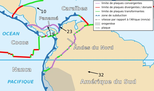
ファイル:North Andes Plate map-fr.png
North_Andes_Plate_map-fr.png (642 × 379 ピクセル、ファイルサイズ: 212キロバイト、MIME タイプ: image/png)
ファイルの履歴
過去の版のファイルを表示するには、その版の日時をクリックしてください。
| 日付と時刻 | サムネイル | 寸法 | 利用者 | コメント | |
|---|---|---|---|---|---|
| 現在の版 | 2006年11月18日 (土) 23:04 |  | 642 × 379 (212キロバイト) | Rémih | {{Information |Description={{fr|Carte de la plaque des Andes du Nord}}{{en|Map of the North Andes Plate}} |Source=Cropped version by myself of Image:Tectonic_plates_boundaries_detailed-fr.svg created by Sting under CC-BY-SA |Date=18/11 |
ファイルの使用状況
グローバルなファイル使用状況
以下に挙げる他のウィキがこの画像を使っています:
- az.wiki.x.io での使用状況
- ca.wiki.x.io での使用状況
- eu.wiki.x.io での使用状況
- fr.wiki.x.io での使用状況
- ko.wiki.x.io での使用状況
- pl.wiki.x.io での使用状況
- ru.wiki.x.io での使用状況
- uk.wiki.x.io での使用状況
- zh.wiki.x.io での使用状況

