オタワ (カンザス州)
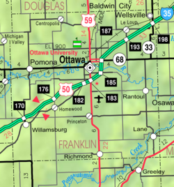
オタワ(Ottawa)は、アメリカ合衆国カンザス州の州都トピカより車で約一時間の小さな町。人口は1万2千人から1万5千人。オタワ大学の所在地。
Ottawa, Kansas | |
|---|---|
 Ottawa Historic District (2018) | |
 Location within Franklin County and Kansas | |
 | |
| 座標:北緯38度37分22秒 西経95度14分07秒 / 北緯38.62278度 西経95.23528度座標: 北緯38度37分22秒 西経95度14分07秒 / 北緯38.62278度 西経95.23528度[1] | |
| Country | United States |
| 州 | カンザス州 |
| 郡 | フランクリン郡 |
| Founded | 1865 |
| Incorporated | 1866 |
| 名の由来 | Ottawa Tribe |
| 政府 | |
| • 種別 | Council-Manager |
| • 市長 | Eric Crowley [2] |
| • City Manager | Richard Nienstedt [3] |
| 面積 | |
| • 合計 | 10.40 mi2 (26.94 km2) |
| • 陸地 | 10.31 mi2 (26.72 km2) |
| • 水域 | 0.09 mi2 (0.23 km2) 1.06% |
| 標高 | 925 ft (282 m) |
| 人口 (2020) | |
| • 合計 | 12,625人 |
| • 密度 | 1,200人/mi2 (470人/km2) |
| 等時帯 | UTC-6 (CST) |
| • 夏時間 | UTC-5 (CDT) |
| ZIPコード |
66067 |
| Area code | 785 |
| FIPS code | 20-53550 |
| GNIS ID | 485638[1] |
| ウェブサイト | ottawaks.gov |
脚注
編集- ^ a b c U.S. Geological Survey Geographic Names Information System: オタワ (カンザス州)
- ^ “City Commission”. City of Ottawa (March 25, 2022). March 26, 2022時点のオリジナルよりアーカイブ。 Template:Cite webの呼び出しエラー:引数 accessdate は必須です。
- ^ “City Manager”. City of Ottawa (March 25, 2022). March 26, 2022時点のオリジナルよりアーカイブ。 Template:Cite webの呼び出しエラー:引数 accessdate は必須です。
- ^ “2019 U.S. Gazetteer Files”. United States Census Bureau. July 24, 2020閲覧。